Between 1901 and 2018, the average sea level rose by approximately 20 centimeters.and this trend has intensified recently, with an increase of around 9.4 centimeters between 1993 and 2023 alone.
The data came from a report by the United Nations Climate Action Teambased on data from NASA and the United States Space Administration. Titled Rising sea levels in a warming worldThe report also incorporates information from the UN’s Intergovernmental Panel on Climate Change (IPCC).
“Worldwide SOS”
António Guterres, UN Secretary General, described The situation was described as “maddening” and said rising sea levels were a crisis entirely caused by humanity.which could soon reach unimaginable proportions with no possibility of escape. In this context, urged G20 nationswhich are the Major emitters of greenhouse gasesto assume their responsibility and lead the efforts to mitigate this threathighlighting that Argentina is also part of this group.
Argentina at risk
Like other coastal countries, Argentina is not immune to the dangers brought by rising sea levels. A study by the Climate Central organization identifies the Atlantic Coast of the province of Buenos Aires, including cities such as Mar del Plata, Pinamar and Villa Gesell, as some of the most vulnerable areas. Likewise, municipalities of Greater Buenos Aires such as Berazategui, Ensenada, Florencio Varela, Lanús and Quilmes are also at risk.
pinamar-beach.jpg
The accelerated rise in sea level is caused by two main factors: the melting of polar ice and the thermal expansion of sea water.
German Garcia Adrasti
Another particularly affected region is the Parana Deltawhere the coasts of the Uruguay River in Entre Ríos stand out, including towns such as Concordia, Concepcion del Uruguay and Gualeguaychu. Low areas in the departments of Diamante, Victoria and Gualeguay are also considered high risk.
Causes of rising sea levels
The UN report attributes the accelerated sea level rise to two main factors related to human-induced global warming: melting of polar ice and thermal expansion of seawaterCindy Fernández, meteorological communicator for the National Meteorological Service (SMN), explained that the melting of glaciers in Antarctica and Greenland, which are covered by enormous layers of ice on land, is one of the main contributors to this phenomenon. When these glaciers melt, they add additional water to the oceans..
Glaciers.jpg

When these glaciers melt, they add additional water to the oceans.
National Geographic
The second factor is the thermal expansionresult of the ocean warming. As the Oceans absorb heat from the increasingly warm air, the water expands, taking up more volumeAlthough this expansion may seem minimal, its impact on sea level is significant, especially in regions such as Oceania and the Southwestern Pacific, which are home to some 25,000 islands.
The Climate Action Team stresses that over the past century, Sea level rise has been faster than in any other century in the past 3,000 yearsAccording to the report, the average rate of increase was 0.13 centimeters per year between 1901 and 1971, increasing to 0.19 centimeters per year between 1971 and 2006, and further accelerating to 0.37 centimeters between 2006 and 2018.
Study in San Antonio Bay: A local case of impact
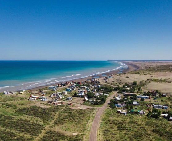
Valentina Fernández, a geologist, focused her degree thesis on models that They assess the impact of rising sea levels in San Antonio Bay, in Río Negro, with a particular focus on San Antonio Oeste. According to Fernandez, This town is already facing problems due to rising sea levels.and the concern about an even more adverse future is palpable.
black river beaches.jpg

San Antonio Oeste is already facing problems due to rising sea levels.
Government of Rio Negro
For his research, Fernández used theoretical models based on topographic surveys, the participation of the local community and tools such as camera traps, which took images every twelve hours for six months. The results, validated by the community, show that San Antonio Oeste is already suffering the consequences of high and south-east tides, which cause flooding of the city. Future scenarios project vulnerable areas expanding, affecting various neighborhoods by 2100.
Source: Ambito
I am an author and journalist who has worked in the entertainment industry for over a decade. I currently work as a news editor at a major news website, and my focus is on covering the latest trends in entertainment. I also write occasional pieces for other outlets, and have authored two books about the entertainment industry.


