
A tsunami caused by a landslide in a fjord in Greenlandcaused by the climate change, shook the Earth for nine days in September 2023revealed an international team of researchers in the journal Science.
“What is completely unique about this event is the duration of the seismic signal and the constancy of its frequency“One of the study’s authors, Kristian Svennevig of the Geological Survey of Denmark and Greenland (GEUS), told AFP on Friday.
“Other landslides and tsunamis have produced seismic signals, but only for a few hours and in a very localized manner. This was observed all over the world, even in Antarctica“, he added.
Climate change triggered a 200-meter-high mega tsunami
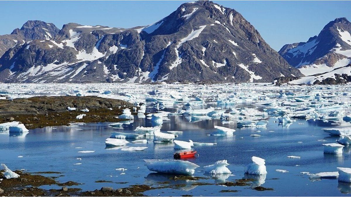
The phenomenon initially surprised the scientific community, which initially classified it as a “unidentified seismic object“, until its origin was determined to be a landslide in Dickson Fjord in eastern Greenland. In September 2023, 25 million cubic metres of rock and ice fell into this remote and uninhabited fjord, almost 200 kilometres from the ocean. This landslide caused a 200 meter high mega tsunami at its epicenter, destroying cultural and archaeological heritage. 70 kilometers away, the tsunami waves, four meters highdamaged a research base located on Ella Island.
The collapse was caused by the shrinkage of the glacier at the base of the mountain.a phenomenon driven by the climate changeexplained GEUS.
Greenland (1).jpg

“With the Arctic continuing to warm, The frequency and magnitude of these events are expected to increase in the future.“Svennevig warned, stressing that he “has no experience with an Arctic as warm as the one we are currently observing.” He also called on establish early warning systemsalthough he acknowledged that it is a challenge in these extreme environments.
Greenland has lost 4 trillion tons of ice in the last 20 years
Scientists have been warning for years that climate change could lead to increased incidence of earthquakes, floods and volcanic eruptions. While not all natural disasters can be attributed to global warming, it seems obvious that as long as the climate continues to change, disasters will be lurking around the corner. And even cause, huge tsunamis.
Greenland has already lost 4 billion tons of ice in the last 20 years due to melting and icebergs breaking offwhich raised global sea level by about 1 centimeter (by the end of the century this could force an additional 10 cm rise).
But the phenomenon is also causing the Earth’s crust to rise around the North Atlantic at a rate of between a few millimetres and 2.5 centimetres per year, according to GPS instruments on the coasts.
Melting ice sheets and landslides could trigger intense underwater seismic activity. Within decades, that could trigger massive earthquakes off the coast of Greenland. and set off tsunamis with disastrous consequences for North America and probably Europe..
In fact, on the other side of the Arctic, Alaska is already experiencing more frequent earthquakes, such as the 8.2 magnitude earthquake on July 28, the strongest in the United States in half a century.
Background
The worst precedent is the “Great Storegga Tsunami” that devastated the coasts of Scandinavia and the British Isles 8,200 years ago. That offshore earthquake was triggered by the release of pressure after the northern European ice sheets melted, triggering a massive landslide of underwater sediments. Geological evidence shows that the tsunami wave then reached between 15 and 20 meters high in the Shetland Islands.
The succession of giant waves that hit the coasts of the North Sea basin killed thousands of inhabitants in Scandinavia, the Faroe Islands, north-east Britain, Denmark and Greenland.
tsunami.jpg

And, interestingly, finished separating Great Britain from the rest of Europe: After the last Ice Age, the sea level was many metres below the current level due to the amount of water that had been frozen, and there was a plain that connected them called Doggerland.
When the glaciation ended and the polar ice began to melt, sea levels rose all over the world and large portions of land were gradually submerged under water. This plain became an island known as Dogger, which was surrounded by a small archipelago, and which came to an abrupt end.
According to a study by Cambridge University, “Storegga’s tsunami” ended up wiping Dogger off the map. Or almost. In the late 19th and early 20th centuries, scientists realised that it still existed as a sandbank 100 kilometres off the east coast of England.
Source: Ambito


