
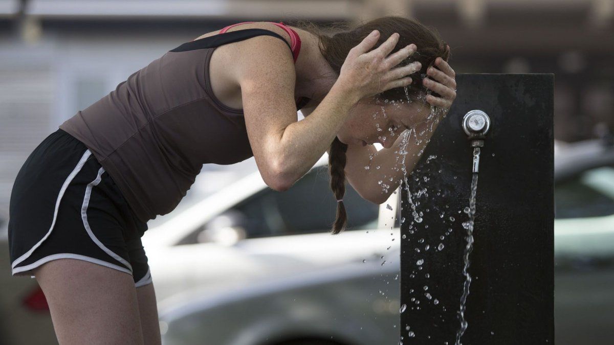
A heat wave It is defined as an excessively warm period in which maximum and minimum temperatures exceed, at least for 3 consecutive days and simultaneouslythe usual values of each locality. This phenomenon that affects our country is due, on this occasion, to a “heat dome“: a atmospheric block which traps hot air over the region and prevents the entry of fresh air and humidity from the Atlantic Ocean, generating a drastic increase in temperatures.
Meteorological studies indicate that Argentina will become the hottest region among several Latin American countries. Extreme temperatures will occur in more than 14 provinces for several days, with warm cores of up to 42°C. The effects of the yellow alert can be dangerous and especially affect risk groups, such as boys and girls, people over 65 years of age, and those with chronic diseases.
Over the center and northeast of Argentina, where more stable weather conditions prevail, the good weather will encourage a sustained rise in temperatures. The critical period of this phenomenon will be until Thursday, where temperatures will reach peaks of 36 to 38 °C in AMBA, and 38 to 40 °C in Rosario and Córdoba, for example.
In this way, the yellow warning predicted by the SMN applies to the provinces of Buenos Aires, Entre Ríos, Corrientes, Misiones, Formosa, Chaco, Salta, Santa Fe, Santiago del Estero, Córdoba, La Rioja, San Luis, La Pampa and Mendoza. In some cases it covers the entire district and in others it covers part of them.
For the City of Buenos Aires and the AMBAthe maximum temperatures will not drop below 30 degrees and the minimum temperatures will range around 21 degrees. The region will have its hottest day on Thursday, with a minimum of 26°C and a maximum of 37°C. However, the SMN announced that on Friday the sky will deteriorate and there will be isolated storms in some parts of the city, with a drop in temperature to a maximum of 32°C and a minimum of 25°C.
Although a large part of the Buenos Aires territory will be affected by the heat, the coastal zone It will maintain high but not suffocating temperatures. The thermal will move between 22°C and 29°C, in Miramar, Mar del Plata, Villa Gesell, Pinamar, San Bernardo, Santa Teresita and San Clemente. Meanwhile, Necochea will reach 30°C.
In almost the entire province of The Pampathe weather will range between 20°C and 38°, with partly cloudy skies, while the thermal peak with 39°C is expected on Wednesday afternoon.
In the northeast of Mendoza There will be isolated storms but temperatures will reach a maximum of 36°C and a minimum of 21°C; with Tuesday as the day with the highest temperature at 38°C. In Saint Louis Heavy rainfall and a peak of 39°C are also expected for the middle of the week.
In Cordovathe temperature will rise until reaching 39°C on Wednesday, with no rain forecast. The most affected cities will be Jesús María, Cosquín, Alta Gracia and Río Cuarto. As in the southern part of Santa Fewhere the temperature will not drop below 35°C and will mainly affect Rosario, Casilda, San Lorenzo, Rafaela and Melincué.
Southeast of Santiago del Esterothe national climate agency warned that highly extreme temperatures are expected between Tuesday and Thursday, with a maximum that will be between 40°C and 41°C, and a minimum between 25°C and 28°C. In RiojaFor its part, the weather will be marked by the arrival of storms, accompanied by a maximum of 32°C.
In Currentsthe high of 39°C will arrive on Thursday, with skies that will range from partly to somewhat cloudy; and with isolated storms on Friday. North of Missions Today there will be a maximum of 33°C and a minimum of 19°C, with isolated storms.
It is estimated that starting Friday a weak cold front will enter the central region of Argentina. Which will increase instability and will probably lead to areas of rain and isolated storms that, together with the rotation of winds, would bring a slight to moderate thermal decrease and cut off this heat wave period in central Argentina.
Tips to protect yourself from high temperatures and avoid heat stroke
- Hydratedrink water more frequently (even when you don’t feel thirsty). Always try to consume safe water.
- Avoid drinks with caffeine or excessive sugar, very cold or very hot.
- Incorporate fruits and vegetables to your diet, and avoid abundant or very heavy meals.
- I reduced physical activity intense.
- Avoid the direct sun exposure during the hottest hours (from 10 a.m. to 4 p.m.). Try to be in well-ventilated spaces.
- Use light clothingloose and light colors; hat and dark glasses.
- Try to keep babies, boys, girls, older adults and pets in cool and well-ventilated places.
Pay attention to warning signs such as: intense thirst and dry mouth, temperature greater than 39º C, excessive sweating, feeling of suffocating heat, dry skin, exhaustion, dizziness or fainting, stomach pains, lack of appetite, nausea or vomiting , headaches, among others.
If the person experiences mild symptoms, it is advised hydrate it immediately and look for shade or a cool place. You can also moisten reddened skin or apply cold water washcloths, especially on the neck, armpits or groin to lower body temperature.
If you have serious symptoms such as confusion, very high fever or fainting, it is recommended to go to a doctor. health center or consult with your family doctor.
In babies, it is important to ensure that the skin is not very irritated by sweat on the neck, chest, armpits, elbow folds and diaper area.
Source: Ambito
David William is a talented author who has made a name for himself in the world of writing. He is a professional author who writes on a wide range of topics, from general interest to opinion news. David is currently working as a writer at 24 hours worlds where he brings his unique perspective and in-depth research to his articles, making them both informative and engaging.


