Almost 6,000 people were evacuated after the Kakhovka Dam collapsed in southern Ukraine. New satellite images show the magnitude of the catastrophe.
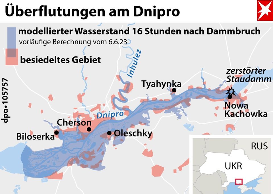
No, the magnitude of the floods is unimaginable. But satellite images can help make the immense destruction along the Dnipro a little more tangible. New images from the US satellite company Maxar Technologies show the region after the breach of the Kakhovka Dam in the south of Ukraine, which was obviously caused deliberately – around 600 square kilometers are affected
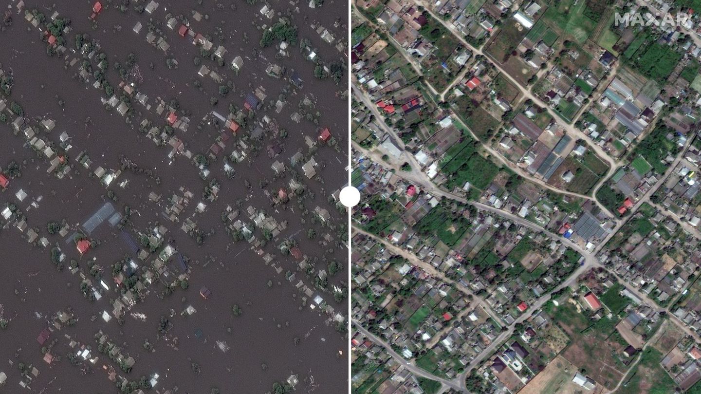
Compared to the situation before the catastrophe, it becomes clear that entire areas have become uninhabitable. Houses, roads, railways, factories, farmland were destroyed. Thousands of people have lost their homes.

Even two days after the dam burst, the full extent of the damage cannot be assessed – nor can the impact on the environment. It is also impossible to foresee what the catastrophe will mean for the course of the war.
However, one thing is clear: the floods cause immeasurable suffering. There are also dangers from mines being washed away, but also from epidemics. The authorities in the Ukrainian-controlled parts of the Dnipro region are already warning of illnesses. On the other hand, little escapes from the Russian-occupied territory. Meanwhile, the masses of water continue to flow – probably for days to come. The water level in the reservoir had dropped by one meter within 24 hours and was 13.05 meters as of Thursday morning, according to the state hydroelectric power plant operator Ukrhydroenergo in Kiev.
New satellite images show flooding from the destroyed Kachowka Dam
In the following graphics you can use the slider to get an idea of the damage. To do this, move the white bar. On the left you can see the situation on June 7, 2023, on the right in May or June before the dam was destroyed.
↑ Detail 1: There is not much left of the once mighty Kachowka Dam. The water makes its way towards the Black Sea.
↑ Excerpt 2: Grain stores in the city of Nowa Kachowka protrude from the water masses. At this point, at least the residential buildings have been spared.
↑ Excerpt 3: Quite different in Oleschky. Streets and houses are flooded here.
↑ Excerpt 4: An overview photo shows the enormous damage caused by the floods in the city.
↑ Excerpt 5: Around 1500 people once lived in the village of Korsunka. Hardly a building was spared by the water of the Dnipro.
↑ Excerpt 6: Fields and pastures were also victims of the floods, here in the village of Krynky.
+++ Read a report from the region around the dam by stern reporter Bettina Sengling: “When water becomes a weapon: what the destruction of the Kachowka dam means for the people in the region” +++
Image source: Satellite Image © 2023 Maxar Technologies
Source: Stern
I have been working in the news industry for over 6 years, first as a reporter and now as an editor. I have covered politics extensively, and my work has appeared in major newspapers and online news outlets around the world. In addition to my writing, I also contribute regularly to 24 Hours World.


